Accueil / British Columbia / Kootenays photo gallery - British Columbia, Canada travel, tourism / Cranbrook 38
East Kootenay Community Community of Cranbrook, BC, Canada
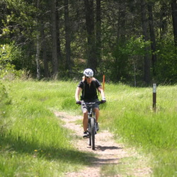
Community Forest
20 photos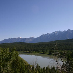
Koocanusa Lake
5 photos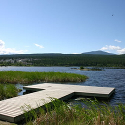
Elizabeth Lake Sanctuary
13 photos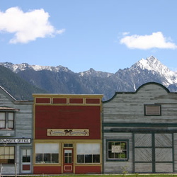
Fort Steele Heritage Town
47 photos
Horseshoe Lake
20 photos
Idlewild Park
16 photos
Isador Canyon Trail
7 photos
Jimsmith Lake Provincial Park
9 photos
Lakit Lake
10 photos
Moyie Lake Provincial Park
11 photos
Norbury Lake Provincial Park
12 photos
North Star Lake
11 photos

 Entrance to Cranbrook Welcome to Cranbrook") Welcome Sign
Welcome Sign
vue 2562 fois
Entrance to Cranbrook Welcome to Cranbrook Highway views of the beginning of the slough Wasa Slough Wildlife Reserve") Wasa Slough Wildlife Reserve
Wasa Slough Wildlife Reserve
vue 2531 fois
Highway views of the beginning of the slough Wasa Slough Wildlife Reserve Highway connecting slough Highway to the slough") Wasa Slough Wildlife Reserve
Wasa Slough Wildlife Reserve
vue 2531 fois
Highway connecting slough Highway to the slough Railway runs along the side of the slough Birdwatching and wildlife") Wasa Slough Wildlfie Reserve
Wasa Slough Wildlfie Reserve
vue 2618 fois
Railway runs along the side of the slough Birdwatching and wildlife Mountain viewed from main street Cranbrook Fisher Mountain in Cranbrook") Fisher Mtn.
Fisher Mtn.
vue 2645 fois
Mountain viewed from main street Cranbrook Fisher Mountain in Cranbrook Mountain best viewed from Cranbrook Fisher Mountain in Cranbrook") Mount Fisher
Mount Fisher
vue 3096 fois
Mountain best viewed from Cranbrook Fisher Mountain in Cranbrook Mountains in the Kootenay River Kootenay River and mountains") Kootenay River Valley
Kootenay River Valley
vue 2445 fois
Mountains in the Kootenay River Kootenay River and mountains Major river in Cranbrook Kootenay River in Cranbrook") Kootenay River
Kootenay River
vue 2494 fois
Major river in Cranbrook Kootenay River in Cranbrook Major river in the Cranbrook area Kootenay River in the region of Cranbrook") Kootenay River
Kootenay River
vue 2559 fois
Major river in the Cranbrook area Kootenay River in the region of Cranbrook Glacier creek near Fort Steele Creek of Cranbrook") Creek
Creek
vue 2494 fois
Glacier creek near Fort Steele Creek of Cranbrook Creek near Fort Steele Creek runs near the historic site of Fort Steele") Creek
Creek
vue 2534 fois
Creek near Fort Steele Creek runs near the historic site of Fort Steele Travel the mountain highways near Cranbrook Highway #93/95 near Cranbrook") Highway #93/95
Highway #93/95
vue 2533 fois
Travel the mountain highways near Cranbrook Highway #93/95 near Cranbrook Highway #95/93 Highway travel near Cranbrook") Highway Driving
Highway Driving
vue 2441 fois
Highway #95/93 Highway travel near Cranbrook Highway travel near Cranbrook Highway leading to Cranbrook") Hwy #93
Hwy #93
vue 2515 fois
Highway travel near Cranbrook Highway leading to Cranbrook The highway strip cutting through town. Highway travel in Cranbrook.") Hwy #3
Hwy #3
vue 2538 fois
The highway strip cutting through town. Highway travel in Cranbrook.