


Join Us
Join Us


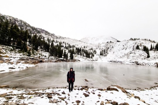
Twin Lakes trail is located in the Okanagan, Canada. It offers stunning views of the Monashee Mountain range and two lakes with the option of overnight camping for you to keep exploring further.
Take HWY 6 from Vernon, BC (+/- 2hrs) towards Cherryville, BC, and turn onto North Fork Road which will take you to the parking lot. As you're traveling on N Fork Rd, turn left when the pavement turns to gravel (look for the yellow 'pavement ends' road sign). Around the 20km mark, the road starts to get rough and extra caution is needed for the last 2 km otherwise the road isn't too bad. The last 400m before the parking lot has a lot of deep ruts/potholes. High clearance vehicles will be fine, however, extra care will need to be taken with lower vehicles. You can always park on the side of the road and walk to the trailhead. From the highway to the parking lot, it will take about 45 minutes.
Internet comes and goes, make sure to download a map before you go. Although there are ribbon markers in the trees and a well-used path, freshly covered snow makes it a bit tricky to find the trail when hiking in the fall or winter. At the parking lot, there's only a picnic table otherwise, start your hike at the trailhead sign.
There are some steep sections and hiking poles and microspikes might be a good option if it has snowed or in general to help you down.
Reaching the lakes is a bit of a steep descend but a gorgeous view of the first lake along with the mountain tops. Keep following the trail to the second lake and take a quick break to enjoy your lunch as well as the view! For more trails in and around Vernon BC Canada(including some of my own) check out Vernon Parks, Trails and Places of Interest, Trails and Places of Interest.
Camping is an option at Twin Lakes but there are no facilities. If camping in the fall or spring, be aware that there is always a possibility of snow and to be prepared accordingly. To return to the parking lot, take the same trail back.
Address:
