Essential Outdoor Gear You Won't Find on Every Hiker's List Gear that Makes the Difference Between Surviving and Thriving on the Trans Canada Trail and Beyond In Hiking Gear Guide Part 2: Beyond the Basics for ...
Essential Gear for Thru-Hikes and the Trans Canada Trail The Ultimate Hiking Gear Guide: Must-Have Items for Long-Distance Adventures In Hiking Gear Guide Part 1: The Basics for Long-Distance Treks in Canada we will shar...
Nature Apps for Camping, Hiking, and Road Trips in Canada Discover how the best apps for nature lovers can transform your outdoor travel in Canada—making it safer, smarter, and more inspiring. Top Nature Apps for Travel ...

British Columbia Parks and Trails

Planning adventures in our British Columbia Parks and Trails

Parks, hiking trails, historic sites, heritage sites, rivers, lakes and natural areas in BC Canada

British Columbia parks and trails in Canada covers every type of landscape and seascape including mountain ranges, rivers, lakes, glaciers, forests, wetlands, wildlife, ecological and heritage. All play a big part in the creation of our BC parks system. Some of our BC Parks and heritage trails tells the long history of Canada. Others are for protection of wildlife, floral and fauna. Then there are those strictly designed for adventures and leisure living outdoors. There are over 11,400,000 hectares of BC parkland in Canada with over 2,700 kilometres of hiking and mountain biking trails.
British Columbia Parks & Trails

Over 800+ BC Parks in the province 

There are over 800 or so British Columbia parks in Canada. This, by no means, is the total number of wilderness and recreation parks in British Columbia, Canada as there are many others that do not fall under the Provincial umbrella. Other parks in the province includes a few National parks and many smaller community, regional, hyro and forestry recreation parks located throughout the province. Only 12.5% of our province is protected by BC Parks and 0.6% is protected by National Parks.

British Columbia Parks and Trails in Canada Summary

British Columbia parks and trails are used for many occasions and activities. The Khutzeymateen Provincial Park is Canada's only grizzly bear sanctuary. The Tweedsmuir Provincial Park is British Columbia's largest provincial park covering 989,616 hectares. On Vancouver Island the 440 metre Della Falls in Strathcona Park is Canada's highest waterfall and is one of the ten highest falls in the world!

Parks are an important part of our province providing thousands an opportunity to enjoy the wilderness outdoors. It is said 6 out of 10 people living in BC visit a park every year.

The British Columbia parks and recreation sites are here for yours and our tourism enjoyment. Please help us care for them and respect them. Do not leave garbage behind. Do not feed the wildlife. Always ask questions on the services, amenities, fees and rules to live by when in the park.

British Columbia Parks and Trails in Canada

Click the BC Regions below to view parks, trails and places in that area.

Cariboo Chilcotin Coast

Cariboo Chilcotin Coast Parks and Trails

Gulf Islands

Gulf Islands Parks and Trails

Haida Gwaii

Haida Gwaii Parks and Trails

Kootenay

Kootenay Parks and Trails

Lower Mainland

Lower Mainland Parks and Trails

North BC

North BC Parks and Trails

Okanagan

Okanagan Parks and Trails

Sunshine Coast

Sunshine Coast Parks and Trails

Thompson Shuswap

Thompson Shuswap Parks and Trails

Whistler Area

Whistler Region Parks and Trails
francois-lake001
Francois Lake is the second longest lake in BC, Canada. The lake stretches out over 25, 750 hectares and reaches a depth of over 87 metres (280 feet). Popular for fishing, boating, canoeing, hiking, flightseeing, circle driving route and camping.
Read more
Highway 35
Burns Lake
mowat
Mowat Bay is a perfect beach for families and friends. The area enjoys a sandy beach, cement theatre like benches, boat launch and great scenery. This is said to be one of the best beach destinations in the Powell River area.
Read more
Mowat Street
Powell River
peakviews (10)
The 1.3 km long trail leading to Gibraltar Rock is all uphill and considered semi-challenging. The trail starts uphill slowly and then continues uphill all the way to the viewpoint. It is a slow gradual climb to the peak with some
Read more
Paul Lake Rd
Kamloops
trail-up-hikers (3)
The park encompasses over 800 hectares of slope on
Mount Dufferin. The highlights include a wide assortment of recreation trails (40 kilometres) and some fantastic views overlooking Kamloops and the Thompson Rivers.
Read more
Kamloops
okanagan-lake-bridge
Okanagan Lake is the largest lake in the Okanagan Valley extending over 135 kilometres long. At one point Okanagan Lake is 5 kilometres wide. It is home to many water activities, sandy beaches, parks and the mythical Ogopogo monster.
Read more
Kelowna
perimeter_trail03
The Perimeter Trail is 13 kilometres long and follows the shores of the Bulkley River, Chicken Creek and Kathlyn Creek. The footpath is an excellent way to explore the many community parks and designated green space in the Smithers region.
Read more
Fulton Avenue
Smithers
water_skiing_on_osoyoos_lake
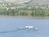
Osoyoos Lake is Canada's warmest lake located in Canada's only desert - the Sonora Desert. The lake is a very popular destination for swimming, boating, canoeing, kayaking, wind surfing, water skiing, sailing and fishing.
Read more
Osoyoos
tex
The Tex Lyon Trail is a historical hiking trail dating back to the 1940s when the north end of the island was in a deep state of discovery. The hiking trail was a trail used by people traveling between Port Hardy and Fort Rupert, British Columbia, Canada. The trail is a little used route today whic
Read more
Port Hardy
naramata_rock_oven_1
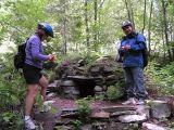
The Rock Oven Regional Park is accessed by hikers and mountain bikers only. The route along the KVR to the rock ovens includes two tunnels and should take 3-4 hours to reach when hiking.
Read more
Smethhurst Road
Naramata
bourbor_falls02
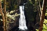
Bourbor Falls Trail in Tumbler Ridge, British Columbia, Canada is a short 800 metre path connecting to a cliff side viewpoint looking out over a river at Boubor Falls. The 1 hour return hike provides a great opportunity to view a towering waterfall without a long, hard hike.
Read more
Murray River Forest Service Road
Tumbler Ridge
parkway
Parkway Trail
Take note bikers and cyclist of this gem of a paved trail in Nanaimo, BC on on Vancouver Island, British Columbia, Canada called The Parkway Trail. It is the most traveled pedestrian and biking trail - a transportation route and a connector route for moving around Nanaimo, BC.
Read more
Trans Canada Hwy
Nanaimo
brent
Brent Mountain Trail is a moderate uphill hike leading to scenic views. The 4.8 km one -way trail leads explorers to the summit of Brent Mountain and 360 degree views of the Okanagan Valley and the Coast and Monashee Mountain Ranges.
Read more
Shatford logging road
Penticton
radium-hot-springs-pools
Radium Hot Springs is a year round attraction located next to the village and within the Kootenay National Park boundaries next to the cliffs of Sinclair Canyon.
Read more
Radium
cablebay
Cable Bay Trail. Hike 1.9 km out to a bay and maybe see some sea lions and eagles. Wood chip trail is easy going and takes maybe 40 minutes. Located south of the Duke Point Hwy
Read more
Nicola Road
Nanaimo
cascade
The Old Cascade Highway is a historic transportation route which is the ultimate day trip through the mountains via a narrow, gravel road traveling over two mountain summits.
Read more
Old Cascade Highway
Rossland
© 2025 Eh Canada Marketing Group