


Join Us
Join Us


The start to the Table Mountain hiking trail is easy to find, because it is located right next to Beaver Mines Lake in the Castle Parks in southwest Alberta, Canada. A park pass is not required to explore both Castle Provincial Park and Castle Wildland Provincial Park, which is a nice bonus. The Table Mountain parking area is in the Beaver Mines Campground and has a small day-use parking lot across from the lake on an unnamed road. Alternatively, there is a larger overflow parking lot not far with a trail leading through the trees by the road until it links up with the main trail near the smaller lot.
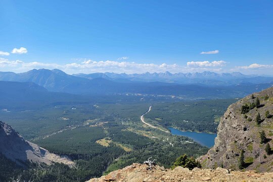
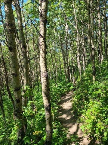
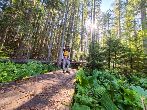
Table Mountain is a very rewarding hike offering amazing views over gorgeous southern Alberta and the Castle region. This hike starts by heading toward Table Mountain through a beautiful forest, and quickly becomes an uphill hike. Moderate to easy through this treed section, it's a lovely hike even if not interested in going the full 10km. After about 1.5-2 km, you'll be mostly above the treeline and can enjoy the stunning views from a cute bench overlooking the lush green forest below. A hike to this area or slightly beyond makes for a fantastic beginner or family friendly trail, with a bit of uphill hiking on a dirt trail with some rocks and roots exposed.
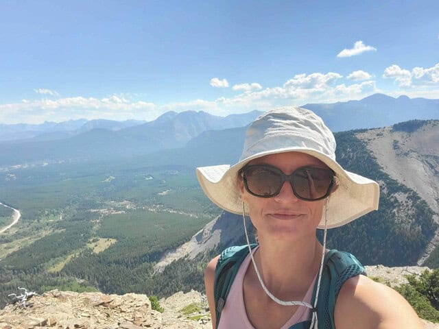
The actual climb up Table Mountain is not recommended for beginners or anyone uncomfortable with unstable loose rock terrain. You can venture past the bench up the beautiful valley for sometime before the trail turns directly up Table Mountain and becomes a rock trail. Again, absolutely breathtaking views from the halfway point in between two mountains, and not a difficult trail up to this point. Once you enter this valley section, you will be fully exposed to the elements from here on out. Southern Alberta is known to be windy, and this trail can definitely prove that some days. Furthermore, the heat on a hot summer day hits differently in the area of the province. You'll likely have no wind on the hottest days and shade is few and far between once reaching the valley. The trail is relativity flat and easy to follow through this section.
If you plan to tackle all of Table Mountain, get ready for some navigation and sure footing over the rocky uphill area. There are small metal markers to watch for and help guide you to stay on the safest trail. They are easily missed so keep a sharp eye out for them as you can very quickly get off trail here. You'll likely use your hands to assist you on this part of the Table Mountain trail. That's what makes this trail a bit of a scramble. With that being said, this is a great trail for people looking to build their skills in mountain scrambling. Basically, Scrambling is hiking with the added need to use your hands in certain sections. Only a small portion of this trail falls into that category.
This trail is a bit deceptive! It honestly feels like 2 false summits before you even see the real one! So don't get your hopes up after the rock climb, there's more to go. Although, the views from the flat lookout after the rocky area are simply amazing. 2 groups decided that way good enough, stayed awhile, then turned back from here. From that point on the trail you'll see what looks like the summit again, it's not yet...but again, phenomenal views if you get up there. From the 1st viewpoint above the rock climb, the trail is a little narrow and tricky for a couple hundred yards then widens out and becomes a simple uphill easy path. The false summit is large offering many vantage points for views, and finally where you'll see the real top of Table Mountain. Again, a bit of an uphill push from here but easy in comparison to the rock section.
This hiking rrail in Alberta can be enjoyed year round with completely different scenery depending on which month it is! With this being a less traveled area of Alberta for many, that means you likely won't see many others on this trail, especially the further you go. You are in a busy wildlife area, so be responsible and prepared for that. Exploring this part of Castle Provincial Park is a fantastic summer activity!
Table Mountain Trail Information
Trail Length- 10.3km
Elevation Gain- 828m
Out and Back
Open Year Round
Time to complete- 3-5hrs
Rated- Moderate to Difficult
Address:
