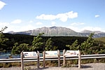
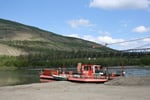
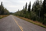
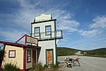
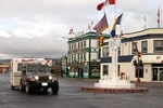
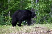
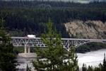
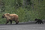
Yukon Driving Routes

A Grizzly Bear and her cubs crossing the Dempster Hwy

Dempster Highway

The Dempster Highway is a transportation route connecting the Yukon Territory with the Northwest Territory in Canada. It is the only highway in Canada which explores in the Arctic Circle. It is one of the best self guided driving tours in Canada.

Emerald Lake Lookout

Klondike Highway

The Klondike Highway is the main north-south travel route in the Yukon Territory, Canada. The highway measures 717 kilometres (445 miles) and stretches from Skagway, Alaska, USA in the south to Dawson City , Yukon, Canada in the north.

Robert Campbell Highway Ferry

Robert Campbell Hwy.

The Robert Campbell Highway is one of the main highway routes in the Yukon Territory for traveling throughout the region. The route explores the remote and often rugged wilderness landscape throughout the central portion of the Yukon.

Silver Trail Highway

Silver Trail Highway

The Silver Trail Highway is the main highway route in the Yukon Territory for traveling to the villages of Mayo, Keno City and Stewart Crossing. The highway follows the banks of the Stewart and Mayo Rivers deep into the wilderness backcountry.

Tagish Highway

Tagish Highway

Tagish Road, also referred to as Highway #8, is a 53 kilometre stretch of road that dips down into the Southern Lakes region of the Yukon Territory from Jake's Corner on the Alaska Highway.

Top of the World Highway

Top of the World Hwy.

The Top of the World Highway (Hwy #9) is a transportation route located west of Dawson City, Yukon Territory, Canada. The highway route connects Canada with the USA. It is a preferred route for sightseeing because it enjoys wilderness scenery & high elevations.
Our Stop in Dawson Creek - Mile 0 of the Alaska Highway

Alaska Highway (Mile 0)

Alaska Highway is a historic, scenic and globally recognized driving routes. Recognized as the "16th Wonder of the Engineered World", the Alaska Hwy route follows a scenic 2,451 km (1523 mi.) paved road from Mile "0" in Dawson Creek, BC, Canada to Delta Junction, Alaska, U.S.A.

Alaska Highway - Black Bear

Alaska Highway (Sec. 1)

The Alaska Highway is divided into three driving routes. Section 1 travels from " Mile 0" in Dawson Creek, BC to Fort Nelson, British Columbia, Canada . It is a total distance of 482 kilometres (300 miles). It is a forested route with rolling hills, mountain views and some not so scenic views of the oil and gas industry.
Alaska Highway - Brown Bear Sighting

Alaska Highway (Sec. 2)

Section 2 of the Alaska Highway begins from Fort Nelson in northern British Columbia, Canada. This section of the highway travels west and is considered one of the more remote and scenic sections of the historic route. There are mountain ridge highways, deep canyons and plenty of wildlife sightings.

Alaska Highway - Teslin River Bridge

Alaska Highway (Sec. 3)

Section 3 of the Alaska Highway begins from Watson Lake in the Yukon and travels through Teslin of the Southern Lakes region, then to Whitehorse and Haines Junction before entering Alaska, USA.

© 2025 Eh Canada Marketing Group