Road Trip Destinations Along the Crowsnest Hwy  Where Is the Crowsnest Pass and What Is There To Do Things To Do In The Crowsnest Pass Alberta Canada. This is a mountain pass highway route, including a mun...
An easy day trip from Vancouver takes you back into time! Take Part in Living History at Kilby Historic Site Exploring British Columbia's Kilby Historic Site is like stepping into a scene from our past making it possible...
Making Snow Cream in Canada Making Winter Treats with Fresh Snow How do you make snow ice cream? It's super easy! I will share how we make our ice cream from fresh fallen snow below. With only 3 simple ingredients, there...

 Barret Hat Hiking Trail


Print
barret-hat-trail02
Houston

Trail Length: 2 km

Difficulty: Moderate
Park Amenities:
Hiking
Sightseeing


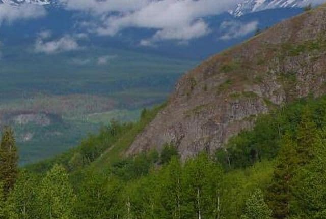
Barret Hat Trail is a great opportunity to go on a short hike leading to mountain and river valley views located just north of Houston, British Columbia, Canada. The lookout point, at one time, was a forestry lookout that was used by the park rangers to spot wild fires. Today, the Barret Hat Trail is a hidden gem of a local hike serving up views of mountain ranges.

The short 2 km or so hiking trail travels along an old overgrown forestry road leading out onto a lookout point with fantastic views of the Telkwa Mountain Range and the Bulkley Valley. The entire hiking route should take 45 minutes to an hour to complete one-way.

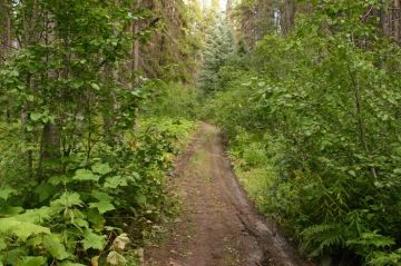
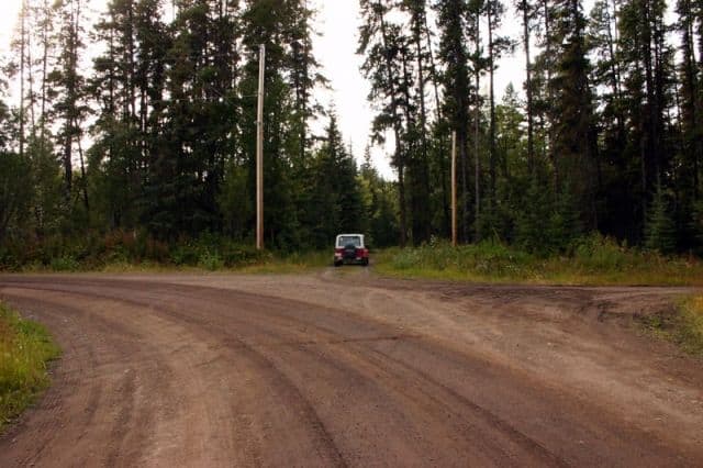
The easy-grade hiking trail starts off by following a fairly wide dirt road up a hill of mud, exposed rock boulders and tree roots. Make note, the hardest part of this trail for us on this trip was making sure we had the right trailhead (deactivated dirt road) because there was no clear signage.

A the top of the hill the route levels out for the first time on a small cleared hilltop. This is as far as you can go by vehicle. Continue following the trail into the shrubs and forest. Soon... the trail narrows and begins to follow some back acreage fencing of a farm before it leads back into the forest again and out to the lookout point.

Explore Barret Hat Hiking Trail in Houston, British Columbia, Canada


Address:

Barret Hat Hiking Trail
Barret Hat Road
Houston
Canada

How To Get ToBarret Hat Hiking Trail

:
This is the tricky part at the time when we explored this hike because of the lack of signage at a three way intersection of gravel roads. From Hwy 16 heading west of Houston, BC turn left onto Barret Hat Road. Continue a short distance down the road to until the road veers left... when you could turn right or go straight. Do not veer left or turn right... go straight through and up the gravel road. Or park at the bottom and walk up.
No reviews yet for Barret Hat Hiking Trail.

Recently Visited BC Parks

Stoney Hill Regional Park East of Duncan British Columbia Canada
Duncan BC

Stoney Hill Regional Park is in the Municipality o...

Sir George Simpson Historic Landmark - East Kootenay B.C.
East Kootenay Historical Landmark Sir George Simpson

The Sir George Simpson historical landmark is loca...

Bear Creek Falls - Glacier National Park Canada
Revelstoke, B.C

Bear Creek Falls in Glacier National Park of Canad...


Hiking With Your Children - Canadian Rockies Family Hiking Guide
Explore British Columbia
Wells Gray Golf & RV Resort - British Columbia, Canada
Find what Birds to Look For in this Park

Come Experience the Nicola Valley!