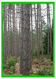
Red Pine Trails

Trail Length: 3.6 kilometres
Park Amenities:
Red Pine Trails is a year round network of trails located in the community of Nestor Falls, Ontario, Canada. The trail network consists of a series of small interconnecting loop trails measuring about 3.6 kilometres in total.
Depending on the hiking and cross country routes explored the trail(s) should not take more than 20 to 90 minutes to complete.
The trail network explores a forest of, both, deciduous and coniferous trees with the largest number of trees being red and white pine trees.
Most of the trails are well marked with directional signs (red and blue markers).
The trail network is mostly level and is considered an easy hike with some sections of elevation hiking. All in all, the route is considered suitable for all ages and fitness levels.
While exploring the Red Pine Trails there are some opportunities for wildlife sightings.
You may encounter a deer or moose here and there as they access the park for getting from A to B. What is more prominent in the park are the birds, especially songbirds.
Explore Red Pine Trails, Nestor Falls, Northern Ontario, Canada
Address:


