- FotogroottesVierkant
Miniatuurafbeelding
XXS - Zeer klein
XS - extra klein
✔ S - klein
M - medium
L - groot
Startpagina / British Columbia / Okanagan Valley photo gallery - British Columbia, Canada travel, tourism / Oliver 32
South Okanagan Community
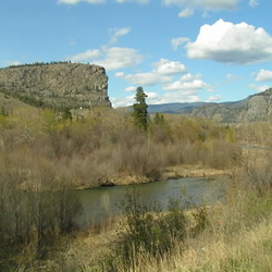
Eagle Bluff
3 foto's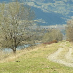
International Bicycling Hiking Society Path
3 foto's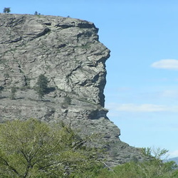
Indian Head
4 foto's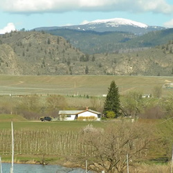
Mt. Baldy
2 foto's
Kettle Valley Railway
4 foto's
Burnell-Sawmill Lake
18 foto's
Triangle Park
3 foto's

 Rows and rows of agriculture Views of an orchard from hilltop.") Orchards
Orchards
1564 hits
Rows and rows of agriculture Views of an orchard from hilltop. Main highway going through community Main highway accessing Oliver, BC") Hwy #97
Hwy #97
1572 hits
Main highway going through community Main highway accessing Oliver, BC Historic site of religion Historic church in town.") Old Church
Old Church
1561 hits
Historic site of religion Historic church in town. Jeep parked in the downtown core Stopping in town for some research") EH Tourism on Location
EH Tourism on Location
1613 hits
Jeep parked in the downtown core Stopping in town for some research Streets of the community Stores of the community") Downtown Oliver
Downtown Oliver
1799 hits
Streets of the community Stores of the community Views of fruit fields and lake Views of Oliver orchards") Orchards
Orchards
1665 hits
Views of fruit fields and lake Views of Oliver orchards Views of some of the countryside Farm fields in the community.") Fields of Oliver
Fields of Oliver
1524 hits
Views of some of the countryside Farm fields in the community. Crosses on hills") Fairview Historic Site
Fairview Historic Site
1650 hits
Crosses on hills East Side Water Canal") Reflections
Reflections
1584 hits
East Side Water Canal East side waterway east side water canal") Water Canal
Water Canal
1456 hits
East side waterway east side water canal Structure near Deadman Lake Old Barn near Deadman Lake") Old Barn
Old Barn
1388 hits
Structure near Deadman Lake Old Barn near Deadman Lake Community park") Lions Park
Lions Park
1541 hits
Community park Oliver Airport Airport near the community of Oliver") Airport
Airport
1570 hits
Oliver Airport Airport near the community of Oliver Views of countryside with bridge Desert Hills near Oliver") Desert Hills
Desert Hills
1435 hits
Views of countryside with bridge Desert Hills near Oliver Desert hills and grapes Wineries in Oliver") Vineyards in the Distance
Vineyards in the Distance
1463 hits
Desert hills and grapes Wineries in Oliver