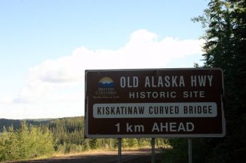
Old Alaska Highway

Park Amenities:
Old Alaska Highway is a section of the original Alaska Highway that, over the years, has been rerouted for safety concerns because commercial trucks have become heavier. A new section of the highway is now in place in order to redirect the heavier commercial trucks away from the historic bridge which could handle no more than 25 tonnes.
The redirection of the route enabled the bridge to remain intact. This is good. But unfortunately, the new highway route directs sightseers away from the historic curved bridge unless they pay close attention to road signs and plan accordingly. It is important to pay attention to the directional signs on the main highway indicating the alternative loop route.
The entire Alaska Hwy follows a scenic 2,451 kilometre (1523 mi.) paved road from Mile "0" in Dawson Creek, British Columbia to Delta Junction, Alaska, U.S.A. It is a famous highway recognized globally as the "16th Wonder of the Engineered World".
At "Mile 21" on the Old Alaska Highway is where the wooden curved bridge crosses the Kiskatinaw River. The alternative driving route drops into a valley and leads to the Kiskatinaw Provincial Park after crossing over the only timber bridge of its kind remaining in Western Canada.
Built in 1942-43 the high banked, curved bridge is an engineering wonder extending 162 metres (534 feet) across. The structure is a called a three span, timber truss bridge and extends about 30 metres (100 feet) above the Kiskatinaw River.
Back in the day the Kiskatinaw River and the valley created problems for the engineers. The shape of the valley and the wacky sharp turn in the river forced the engineers to come up with a plan to build a banked curved bridge. The engineers created the 190 foot wooden bridge with a 9 degree curve to conform with the bend of the highway. The construction of the bridge took 9 months to complete.
Old Alaska Highway located north of Dawson Creek, British Columbia, Canada
Address:


