Bear Mountain Trail

Trail Length: 10 kilometre
Difficulty: Difficult
Park Amenities:
The Bear Mountain Trail is a 10 kilometre (6.3 miles) one-way (20 km return) wilderness hiking trail which explores through second growth forest leading to the peak on Bear Mountain. The summit measures about 1050 metres.
The hiking trail is considered a challenging and difficult route consisting of switchbacks, mud, bugs and steep climbs. From start to finish the total elevation gain of the hiking trail measures about 1010 metres (3200 ft).
The Bear Mountain Trail is for hikers with good fitness levels and hiking skills. Most of the hike is uphill. Watch for exposed tree roots and rocks. Wear good clothing (layers) and pack water and snacks. Be aware weather conditions can change quickly on the mountain.
The wilderness trail follows an old logging road, double and single track gravel and grass trails. There are sections of the trail which are poorly marked so trail finding skills are an asset. Some sections, near the peak of the mountain, are also poorly maintained and often covered in overgrown brush and deadfall trees.
The trail is considered an all day adventure. From the logging road gate (trailhead) to Bear Lake is 6 kilometres one-way. Some groups make the lake the end game of the hike. Most of this section of the hike is in the trees... and the highlight would be the waterfalls and the lake.
From the lake to the peak of the mountain the trail conditions get far worst. There is more mud, bugs and less clear view of the trail. It is not uncommon to lose sight of the trail due to brush and dead fall trees.
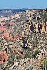
From the lake to the summit is approximately 4 kilometres. There is a clearing and a lookout viewpoint at the summit. From the lookout the views of the valley open right up. The hike is well worth the effort. There are views of Mount Cheam, the Village of Hope, Mount Baker, Harrison Lake and Seabird Island.
Explore Bear Mountan Trail near Harrison Hot Springs, BC, Canada in the Fraser Valley Area of British Columbia, Canada.
Address:
How To Get ToBear Mountain Trail
:From Harrison Hot Springs travel east on Lillooet Avenue for about 5.2 kilometres. At the small hill, near the top, take a right turn onto a gravel road. Park at the gate and hike.


