Roberts Creek
British Columbia
Canada
Trail Length: 7.5 kmDifficulty: ModeratePark Amenities:
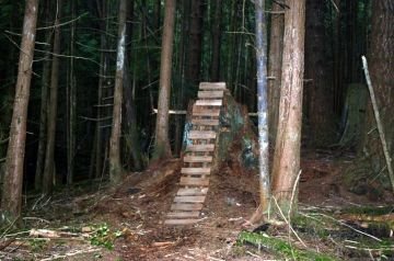
Brodie Mountain Biking Loop Trail is located in the Roberts Creek, BC area on the lower Sunshine Coast north of Gibsons B.C., south of Sechelt, British Columbia, Canada. The route is an advanced mountain bike adventure that covers 7.5 km (4.5 mi.) climbing steep logging roads, cutting through forests, getting air time while gaining some speed downhill. The total Brodie Bike Loop Trail should take about 1 - 1.5 hours to complete.
The Brodie Bike Loop Trail route is identified by the white biking signs and the double rings of orange paint and the letter "B" on trees. Driving from Gibsons take a right onto the Roberts Creek Forest Service Road. Continue to the overhead power-lines and park.
First, you must take a left from the power-lines and then turn right into the forest cover at 450 m (1476 ft.). Mountain bike over Roberts Creek continuing for another 800 m (2624 ft.) and then take another right. Steep climbs for about 1.5 km ( 0.8 mi.) then take a right turn on to the logging road. Continue forward until the next junction and take a left and continue for 500 m (1640 ft.) and then turn into the forest cover again. Hold on tight for the downhill run back to the power-lines.
Brodie Mountain Biking Trail, Roberts Creek, BC on the Sunshine Coast.
Address:
Brodie Mountain Biking Loop Trail
Roberts Creek Forestry Service Road
Roberts Creek
Canada
How To Get ToBrodie Mountain Biking Loop Trail
:
How to Get Here: Follow Hwy 101 north from Gibsons, BC for 10 km (6 mi.) or drive south on Hwy 101 from Sechelt BC to Roberts Creek. Approaching from Sechelt take a left on to Roberts Creek Forestry Service Road. If you past the Cliff Gilker Park you have driven 500 m (1640 ft.) too far. Go back and find the Roberts Creek Forestry Service Road and travel along the road for 1 km (0.6 mi.) to the power-lines and then park and go.

brodie_mountain_bike_trial 008

brodie_mountain_bike_trial 006
No reviews yet for Brodie Mountain Biking Loop Trail.
