Radium Hot Springs
British Columbia
Canada
Park Size: 1,406 sq. kilometresTrail Length: 3.2 km one-wayDifficulty: ModeratePark Amenities:
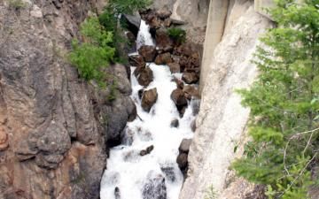
Juniper Trail is a short trail exploring canyon walls and forest groves high above Sinclair Creek in the Kootenay National Park of British Columbia, Canada near the town of Radium Hot Springs, BC.
Juniper Trail is one of the many hiking trails located in the Kootenay National Park which enable visitors to explore deep into the backcountry. The Juniper Trail is the first marked hiking trail when entering the park from the 'west gate' which is located just outside the community of Radium Hot Springs.
The one way hiking trail is a 3.2 km long hike. The hiking trail starts from Highway #93 and, right away, begins going downhill. The trail continues exploring along the north ridge of Sinclair Canyon eventually dropping down into Sinclair Creek. Hikers can return the same way they came from or.. continue along the connector trail to the parking lot of the hot springs in Radium.
Juniper Trail is a moderately difficult hike. Individuals should be well prepared with water and good hiking boots. The trail is an earthy path. A single track path with exposed tree roots, high ridges and exposed rocks. The trail is full of climbs and descents, some hills harder than others. However it is a well maintained and a well marked trail route.
Important Note: To explore in the Kootenay National Park one must obtain a park pass. Passes are available in the community of Radium Hot Springs or through any national park office.
Kootenay National Park near Radium Hot Springs in British Columbia, Canada.
Address:
Juniper Trail - Kootenay National Park
Highway 93
Radium Hot Springs
Canada
How To Get ToJuniper Trail - Kootenay National Park
:
How to Get Here: From Radium travel along Hwy #93 into the Kootenay National Park. Entering the park is a 'west gate' where you will see a small pull out parking area on your left with a trailhead sign.
No reviews yet for Juniper Trail - Kootenay National Park.

