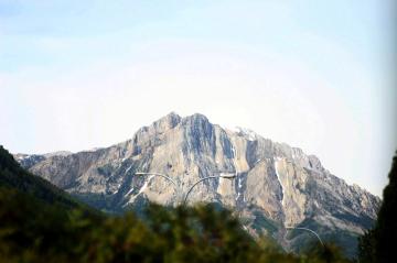
Hosmer Mountain Trail, Fernie

Trail Length: 5 kilometres
Difficulty: Difficult
Park Amenities:
Hosmer Mountain Trail leads up to a peak offering far reaching views of the valley below. The mountain recreation trail is tucked away in the backcountry forests located north of Fernie, BC in the East Kootenay region of British Columbia, Canada.
Mount Hosmer Hiking Trail is split into two sections. The first section of the hiking trail follows a narrow path up hill for about 3 kilometres (1.9 mi.). The trail is mostly dirt and earth, with exposed roots and rocks. The first 3 kilometres ends at the base of Ghostrider Peak on Mount Hosmer.
The first section of the Mount Hosmer Hiking Trail takes about 2- 4 hours to complete - based on your fitness levels. The trail is considered moderately difficult as it includes some switchbacks and steep hills. In total the elevation gain on this hike is over 700 metres. The peak is measured at 2,340 metres (7676 ft.).
The second section of the trail leads to the summit of Hosmer Mountain. It starts off relatively easy and then near the peak it becomes steep. This section of the trail is 2 kilometres. Most of the trail navigates along a ridge leading to the top of the summit. The trail is mostly unmarked and is unmaintained.
It is important to prepare for this hike. All hikers should have good hiking boots, a hat and pack in plenty of water. It can get hot or cold on the mountain. There is very little cover from the elements when accessing the peak. There is no water source on this hike.
All hikers in the wilderness backcountry should be well prepared for wildlife. Keep an eye out for the mountain goats who roam the area. And be aware this is also bear country.
Hosmer Mountain Hiking Trail, Fernie, BC, Canada in the Kootenays
Address:


