North and South Boundary Trail

Difficulty: Moderate
Park Amenities:
The Boundary Trail is a long haul, year round backcountry route exploring both the provinces of Alberta and British Columbia, Canada. The trail is divided into two distinct sections called the North and South Boundary Trail. The Alberta section of the Boundary Trail is considered the longest backcountry trail in Jasper National Park.
 Both trails explore deep into the wilderness. Both trails are challenging, rough and very tough. The routes are susceptible to extreme changing weather conditions due to the fact most of the hike is above the tree line. And in many cases the routes travel though bear country and mosquito country so it is wise to always be alert and prepared.
The North and South Boundary trails in Jasper National Park are popular routes for long distance activities like horseback riding, backpacking, fishing and wilderness camping in the summer and cross country skiing in the winter.
Although each route is different, they both require explorers to be self sufficient and experienced in the backcountry. For the inexperienced there are local tour and guiding companies providing adventures exploring throughout the backcountry wilderness regions along both the North and South Boundary Trails.
South Boundary Trail
The South Boundary Trail explores the Jasper and Banff National Parks - however most of the route is in Jasper. The trail measures 166 kilometres long, give or take, with an elevation gain of 790 metres with a peak elevation measuring over 2300 metres.
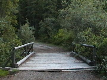
The South Boundary Trail explores river valleys, mountain passes and wildflower meadows. The trail is mostly, well marked with distance and directions signs. And all the rivers are bridged for crossing.
Near the north end of the South Boundary Trail the route connects and continues along the Jonas Pass Trail and the Nigel Pass Trail which is located south of the Columbia Icefields.
Along the South Boundary Trail are wilderness campsites. Most are equipped with tenting pads, bear poles/food cache and pit toilets. Many of the more developed camps are located on the south end of the trail. Some of the wilderness campsites located along the route include the Arete Camp, Isaac Creek Camp, Medicine Tent Camp, Grizzly Camp and the Jaques Lake Camp.
The South Boundary Trail is a scenic journey through some pristine wilderness regions with many mountain ranges and mountain peaks to view. Some of the mountains along the route include Mount Isaac (2892 metres), Mount Dalhousie (2438 metres), Deception Mountain (2819 metres) and Mount Allen (2653 metres).
North Boundary Trail
The North Boundary Trail explores the Jasper National Park in Alberta, Canada and the Mount Robson Park in British Columbia. Most of the route is in the Jasper Park and only 22 kilometres of the trail follows the Berg Lake Trail in Mount Robson Park in British Columbia, Canada.
The North Boundary Trail measures 192 kilometres long, give or take, with an elevation gain of 1050 metres with a peak elevation measuring over 2020 metres. Like the south trail, the north trail is rugged and tough with all river crossings bridged. Which is good because much of the trail follows the Snake Indian River.
There are wilderness camps located along the trail. Most are equipped with tenting pads, bear poles/food cache and pit toilets. And like the south trail there are some impressive mountain peaks to view like Mumm Peak (2962 metres), Gendarme Mountain (2922 metres) Palu Mountain (2652 metres) and the Twin Tree Mountain (2544 metres).
The best time to explore both of these trails is during the late summer, early fall months when mosquito populations are lower.
Address:


